Natural Calamities 2013


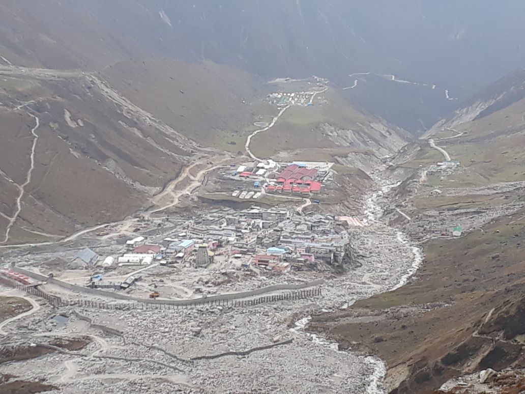
In the month of June 2013, the region suffered its worst disaster in its living memory with widespread destruction. The disaster coincided with the peak tourist and pilgrimage season, considerably enhancing the number of casualties with adverse impact on the immediate rescue and relief operations.

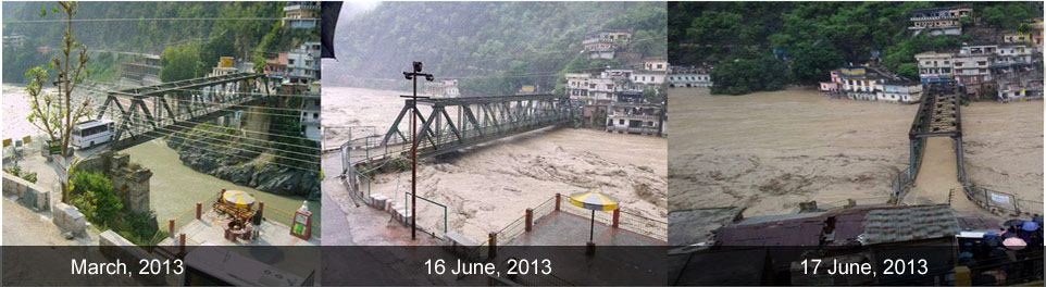
The entire region of the state was hit by ‘heavy’ to ‘very heavy’ rainfall, resulting in flash floods and landslides over a wide area. Uttarakhand and adjoining areas experienced heavy rainfall, which was about 375 percent more than the benchmark rainfall during a normal monsoon. The districts of Bageshwar, Chamoli, Pithoragarh, Rudyaprayag and Uttarkashi were the worst effected. Large populations in several areas were cut off across the States and suffered due to shortage of essential commodities.

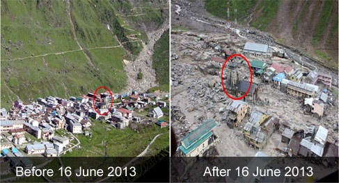
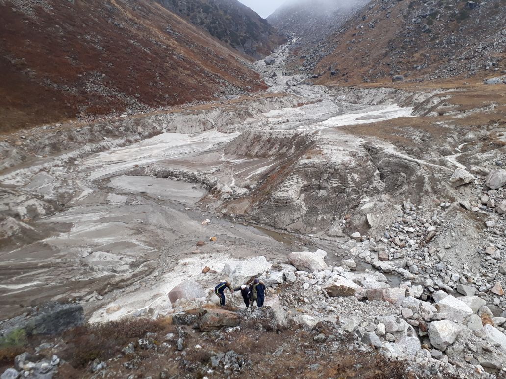
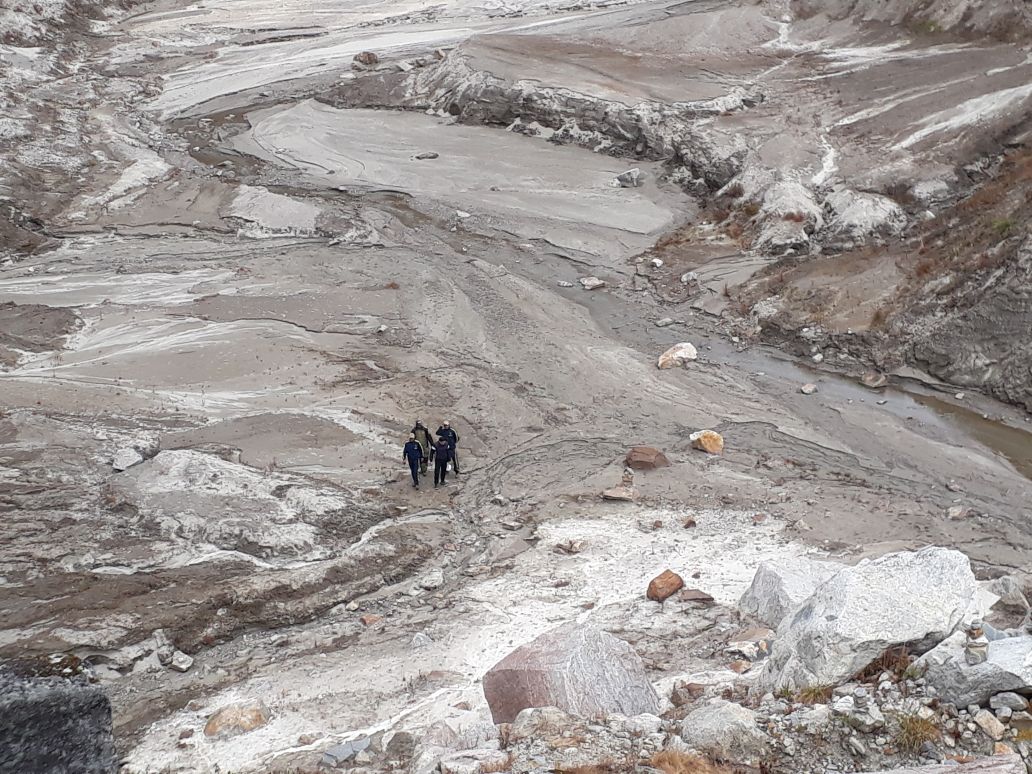
Nature’s fury was most pronounced in the Mandakini valley of the Rudraprayag district. Heavy rains caused the melting of Chorabari Glacier at the height of 3800 metres, and eruption of the Mandakini River which led to heavy floods near Gobindghat, Kedar Dome, Rudraprayag district, Uttarakhand and adjacent areas. It was also observed that very heavy and incessant rains during the period resulted in exceptionally high rise in the river discharges.


The rise in the river level was of the order of 5-7m where the valley was wide and 10-12m where the valley was narrow. In the upper stretches of Mandakini, the stream gradient is high and valley profile is mostly narrow. The gush of water running down from Kedarnath and Rambara areas brought mammoth sediment load consisting of huge rock boulders (diameter ranging from 3 to 10m). The heavy sediment load along with big boulders acted as tools of destruction and took away everything that came in their way. The enormous volume of water induced erosion along all the river valleys which in turn triggered landslides at a number of places.

Torrential rains coupled with the collapse of the Chorabari lake led to flooding at the Kedarnath shrine and the adjacent areas of Rambara, Agastyamuni, Tilwara and Guptkashi.


Event 1- On 16 June 2013, at 5:15 pm, torrential rains flooded the Saraswati River and Dudh Ganga catchment area, resulting in excessive flow and heavy soil erosion across all the channels. The flood waters along with the accumulated debris moved towards Kedarnath town, washing off theupper part of the city (Sankaracharya Samadhi, Jalnigam guesthouse, Bharat Seva Sangh Ashram, etc.) and leading to the biggest ever devastation witnessed in this region. Due to heavy downpour, the town of Rambara was completely washed away on the evening of 16 June.

Event 2- On 17 June, 2013 another disaster struck at 6:45 am. It was caused by overflow and collapse of Chorabari Lake whish released large volume of water that caused another flash flood in the Kedarnath town leading to heavy devastation downstream (Gaurikund, Sonprayag, Phata etc.).

The disaster, termed as Himalayan Tsunami by the media, caused wide spread loss of lives and damage to infrastructure, property and environment with a resultant impact on the livelihoods and local economies. As per the reports, a total of 169 people died and 4,021 people were reported missing (presumed to be dead). About 4,200 villages were affected; 11,091 livestock were lost and 2,513 houses were completely damaged.

A large number of tourists and local inhabitants were stranded in the difficult mountain terrain of the upper regions of the Himalayas who were later rescued by the army and para-military forces. (Source: National Institute of Disaster Management (NIDM), Ministry of Home Affairs, Govt. of India)